Global Reach of OpenECPDS
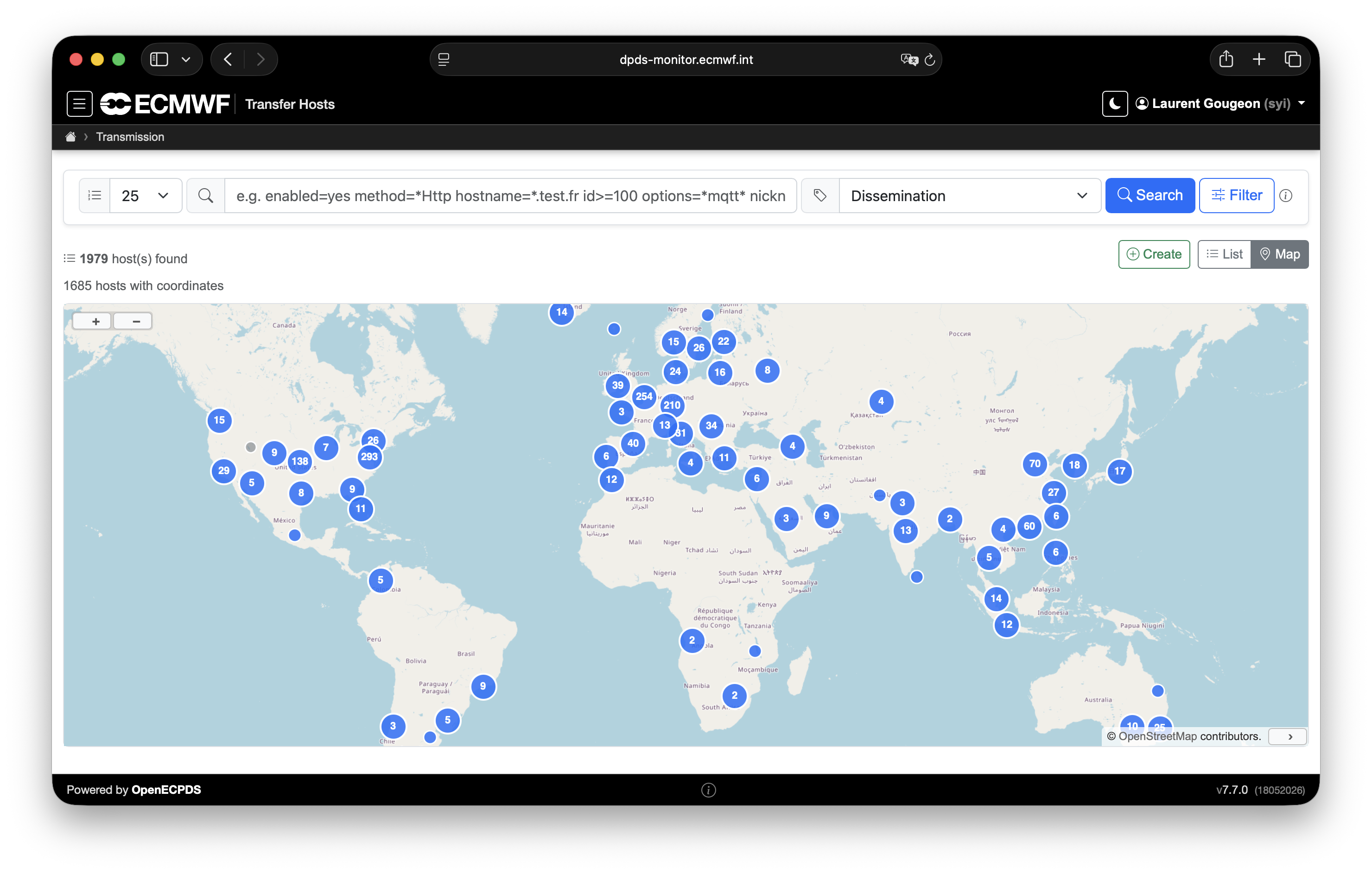
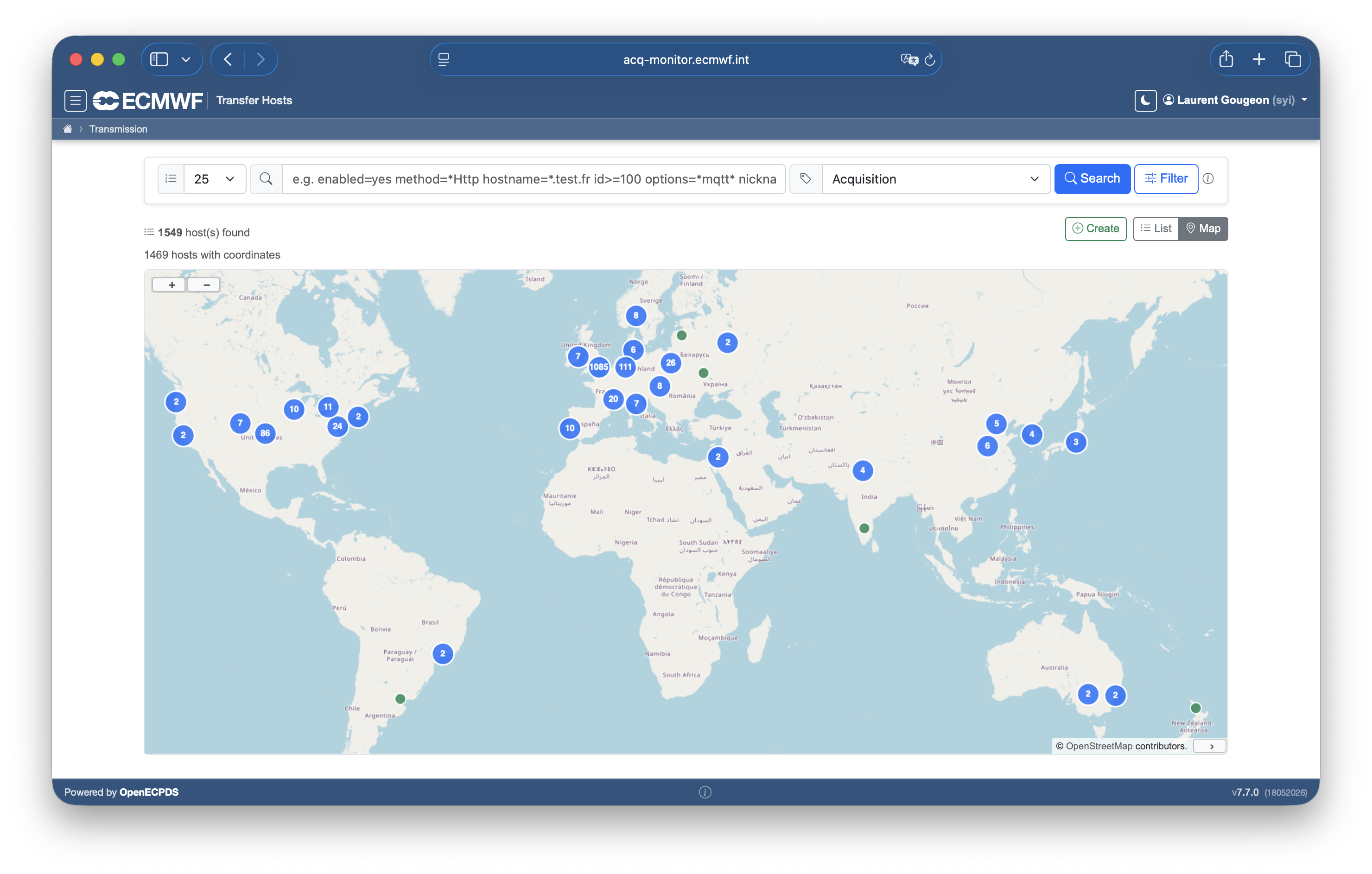
The OpenECPDS infrastructure supports a vast network of over 1,000 destinations for acquisition and dissemination, marking a significant milestone in its expansion. Spanning more than 80 countries, this network enables continuous, around-the-clock data exchange. A live map, available through the OpenECPDS Web Interface, provides real-time monitoring of both dissemination and acquisition activities.
To further optimise performance and reduce latency for transatlantic transfers, a Continental Data Mover has been deployed in the United States, strategically positioned to enhance data delivery to North American recipients.
The OpenECPDS Web Interface provides global infrastructure maps for both data dissemination and data acquisition, highlighting all served destinations and providing a clear visual representation of the system's extensive reach.
A corresponding view is available for the acquisition service:
Warning
Map pins may represent multiple destinations in dense areas. When applicable, the number of hosts is shown inside the pin.
Note
Geolocation in OpenECPDS is based on the GeoLite2-City database, which performs IP-to-location mapping. The resulting locations are approximate and accuracy may vary depending on the IP data available.
Long-term data volume trend
In addition to the global view, it is useful to observe how data volumes have evolved over time. The annual average monthly data volume (in terabytes) handled by OpenECPDS from 2007 to 2025 highlights the steady and continuous growth of data transfers over eighteen years, reflecting both an expanding user base and the increasing scale of operational activities.
